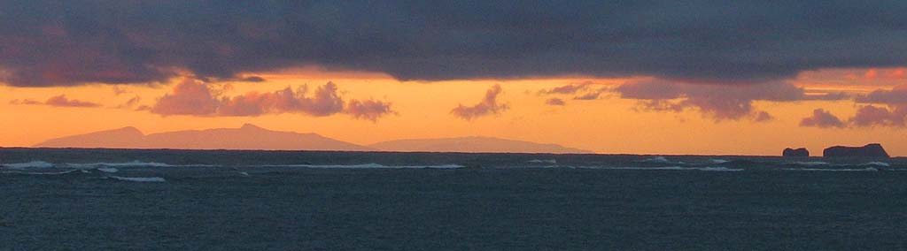
What islands are we seeing from the beach in Kaaawa?
This photo was taken on Monday, September 6, 2004. You may have to scroll for the full width.
This photo was taken on Monday, September 6, 2004. You may have to scroll for the full width.
|
What islands are we seeing from the beach in Kaaawa?
This photo was taken on Monday, September 6, 2004. You may have to scroll for the full width. |
|
|
| No definitive answer has been forthcoming. I've tried maps and nautical charts, but by themselves they don't provide a straight forward answer. I've waited for someone with an expert opinion, but it hasn't come.
So I'll try a different approach. How much of Molokai, Maui, Lanai, or the Big Island can we see from Kaaawa? Turns out that's a question with an answer that can be calculated. Click here for a relatively straight forward discussion of the theory and the math to get an answer. Here's another link to a page that includes a chart of various heights and distances (using the chart avoids having to work with the formula). A bit more information is still needed to begin answering the question of what we can see from Kaaawa. First, how far is it to the other islands? Here's a table that reports the distance from Honolulu airport to each of the other island airports, a rough measure of their distance from us. For heights of other islands, check this list of the highest mountains in Hawaii. That's enough data for at least some rough answers. For example, it's some 168 miles to the Kona airport and over 200 miles to Hilo. To be seen at a distance of 159 miles, a mountain on the Big Island would have to be 3.11 miles high, or something over 16,000 feet, and both Mauna Loa and Mauna Kea are under 14,000 feet. That seems to indicate that we can't see the Big Island from here. The highest point on Lanai might just barely be visible, and about half of Molokai and much of Haleakala should be visible, by my reckoning. I still can't figure out what we're seeing, but at least I can start to rule out things that we most likely are unable to see from here. Although, of course, I could be misreading or misapplying all this new information. Comments? Please let me know (ian@ilind.net). |