You wouldn’t know that Tropical Storm Guillermo is in the neighborhood, at least not from the view from the beach in Kaaawa at dawn this morning.

Discover more from i L i n d
Subscribe to get the latest posts sent to your email.
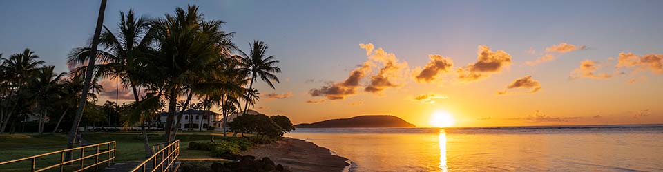
You wouldn’t know that Tropical Storm Guillermo is in the neighborhood, at least not from the view from the beach in Kaaawa at dawn this morning.
Subscribe to get the latest posts sent to your email.
Yesterday, one of the weather service’s computer models predicted two tropical disturbances forming very rapidly just southeast of the Big Island sometime in the next several days. The weather service discarded the forecast as an outlier because none of the other computer models forecast a similar “solution”.
Today, several of the computer models are predicting the formation of a tropical disturbance about 650 miles southeast of the Big Island on Tuesday. When several models arrive at the same solution, it can no longer be discarded as abnormal or an outlier.
If something were to form where predicted, it would be a Hawaii-named stormed, and south of us…a very dangerous combination. Then there’s the matter of what it would do. Forming is one thing…moving is another. On the plus side, if it forms where predicted, it will be relatively close to the islands, and presumably wouldn’t have a lot of time to strengthen into something truly dangerous unless it spends a few days moving west and then turns norths (like Iniki did). On the down side, if it forms where predicted, it will already be stronger than Felicia was when it eventually rolled through. A tropical disturbance 650 miles southeast of the Big Island still would have enough time to mature into a tropical storm, and if it moved north or northwest, could bring some strong winds and rain. If it started moving at around 15mph, it would take about 40 hours to cover 650 miles. A lot can happen in 40 hours.
One more thing, if both those storms get named, then one of them will begin with ‘I’, like Iwa or Iniki…