New evacuation zones announced for potential “extreme tsunami”

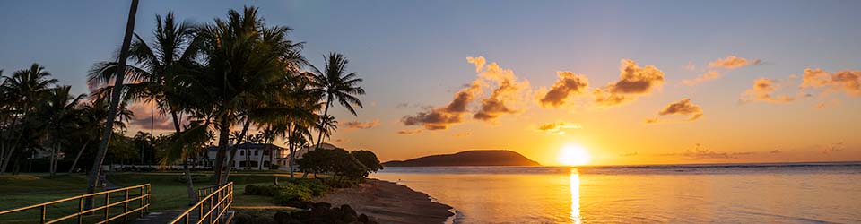
The city is updating its tsunami evacuation maps in order to take into account the potential of an “extreme” tsunami that is more powerful than anything in Hawaii’s recorded history. This is being referred to as a “low probability but high impact” event.

New evacuation maps have been drafted and are now available online in draft form. In addition, the city has scheduled a series of community meetings to be held around the island to discuss the new “extreme tsunami” plans.

Here’s the city’s explanation. Click here for the list of community meetings, and to see the new maps in draft form.

Extreme Tsunami Evacuation Zones

Click here to skip down to a link to all of the DRAFT Extreme Tsunami Evacuation Maps.

O‘ahu residents are invited to attend a series of free public information outreach workshops for a preview of new Extreme Tsunami Evacuation Zone maps. These maps represent an unlikely worst-case scenario and do not replace the current, standard tsunami evacuation maps. Rather, they add a second evacuation zone for an Extreme Tsunami event (Magnitude 9+ earthquake and tsunami).

Newly released scientific and geological information suggests that sometime in the past 500 years, a massive 9.0 earthquake in the eastern Aleutian Trench may have generated a tsunami that far exceeded the inundations known to have occurred during tsunami events throughout recorded history in Hawaii. An event of this magnitude, referred to as an Extreme Tsunami has a low probability but high impact.

In response to these findings, the city, in conjunction with state, federal, and non-government stakeholders, have developed a new set of O‘ahu Extreme Tsunami Evacuation Zone maps, refuge areas, and evacuation routes to complement the current tsunami evacuation maps.

Seventeen outreach workshops will be held in coastal communities around O‘ahu this month and next. Each workshop is designed specifically for that particular community.

Representatives from the city’s Department of Emergency Management will be on hand to present the new maps, discuss the implications for Oahu residents, and answer questions.


Discover more from i L i n d

Subscribe to get the latest posts sent to your email.

4 thoughts on “New evacuation zones announced for potential “extreme tsunami”

  1. Richard Gozinya

    I’ll bet most townies don’t know that the extreme tsunami zone goes from the ocean all the way up to King Street. That’s one heck of an inundation.

    Reply
  2. A.nonymous

    Is that the inundation that would happen if Puna fell into the ocean? I always figured you’d need to be on top of Tantalus to survive that one.

    Reply
  3. compare and decide

    “Is that the inundation that would happen if Puna fell into the ocean?”

    It might not be Puna that would calve into the ocean, but rather Ka’u, further south.

    http://www.gohawaii.com/big-island/regions-neighborhoods/kau

    Once upon a time, all the islands were large, but they crumbled as they moved north away from the hot spot. There are ‘rocks’ the size of the island of Manhattan at the base of the islands.

    In any case, megatsunamis are caused by such events like landslides and meteors, rather than the earthquakes that cause “mere” tsunamis.

    http://en.wikipedia.org/wiki/Megatsunami

    Reply
  4. compare and decide

    I am reading contradictory statements on the potential for a major landslide on the Big Island.

    http://en.wikipedia.org/wiki/Hilina_Slump

    The Hilina Slump is a 5,000 cubic mile (20,000 kilometre³) section of the Big Island of Hawaii on the south flank of the Kilauea volcano. Between 1990 and 1993, Global Positioning System measurements showed a southward displacement of the south flank of Kilauea up to approximately 10 centimeters per year.[1] The slump has the potential of breaking away at a faster pace in the form of an underwater landslide. In Hawaii, landslides of this nature are called debris avalanches. If the entire Hilina Slump were to slide into the ocean at once, it could cause an earthquake in excess of a 9 in magnitude, and a megatsunami. Previous megatsunamis in Hawaii 110,000 years ago caused by similar geological phenomena created waves 1,600 feet (500 m) tall.[2] Were such a megatsunami to occur again, it would threaten the entire Pacific Rim.

    But here is something from the US government from 1998 that is much more reassuring.

    http://hvo.wr.usgs.gov/volcanowatch/archive/1998/98_07_16.html

    In a recent national television program on tsunami, attention was focused on the Great Crack in the southwest rift zone of Kilauea. The size of the crack was presented as evidence that the south flank was breaking away from the island. The gaping fissure is impressive for its continuous length of 13 km (8 mi), width up to 15 m (50 ft), and depth of 20 m (66 ft). This feature, however, is the result of crustal dilation from magmatic intrusions into the rift zone and not from the seaward movement of the south flank. There is no evidence that the Great Crack is getting bigger at this time or that the island is tearing apart along this seam.

    The present intact nature of the delicate 1823 flow indicates that there was no growth of the Great Crack during the largest historic earthquake (magnitude 7.9) in 1868. Measurements spanning the magnitude-7.2 south flank earthquake in 1975 show no change across the area. Thus, the two largest earthquakes in historic time have not affected the Great Crack.

    The east and southwest rift zones together with the Koa`e fault system form the north and west boundaries of the south flank block of Kilauea. Bathymetric studies around the Hawaiian Islands identify numerous giant submarine landslides from the islands. The south flank block is identified as a possible future landslide that could generate a large tsunami, but these phenomena occur so infrequently (perhaps once every few tens of thousands of years) that we should not lose any sleep over it ever happening. We will have ample warning before it goes.

    What we should concern ourselves with are the large (greater than magnitude 6) earthquakes that frequently originate in the south flank. We must build structures that can withstand the shaking caused by these earthquakes and ensure that furnishings are also well secured. We must become aware that a large earthquake can generate a tsunami, as in 1868 and in 1975, and if we are near the seacoast when the ground shakes, we should move inland to higher ground as quickly as possible.

    The total breakaway of the south flank block of Kilauea mentioned in the television program is not taking place at this time. The U.S. Geological Survey’s Hawaiian Volcano Observatory is constantly monitoring this area and will immediately inform the Hawaii County Civil Defense agency if anything unusual occurs.

    Who to trust? Wikipedia? Or the US federal government?…

    Reply

Leave a Reply

Your email address will not be published. Required fields are marked *

This site uses Akismet to reduce spam. Learn how your comment data is processed.