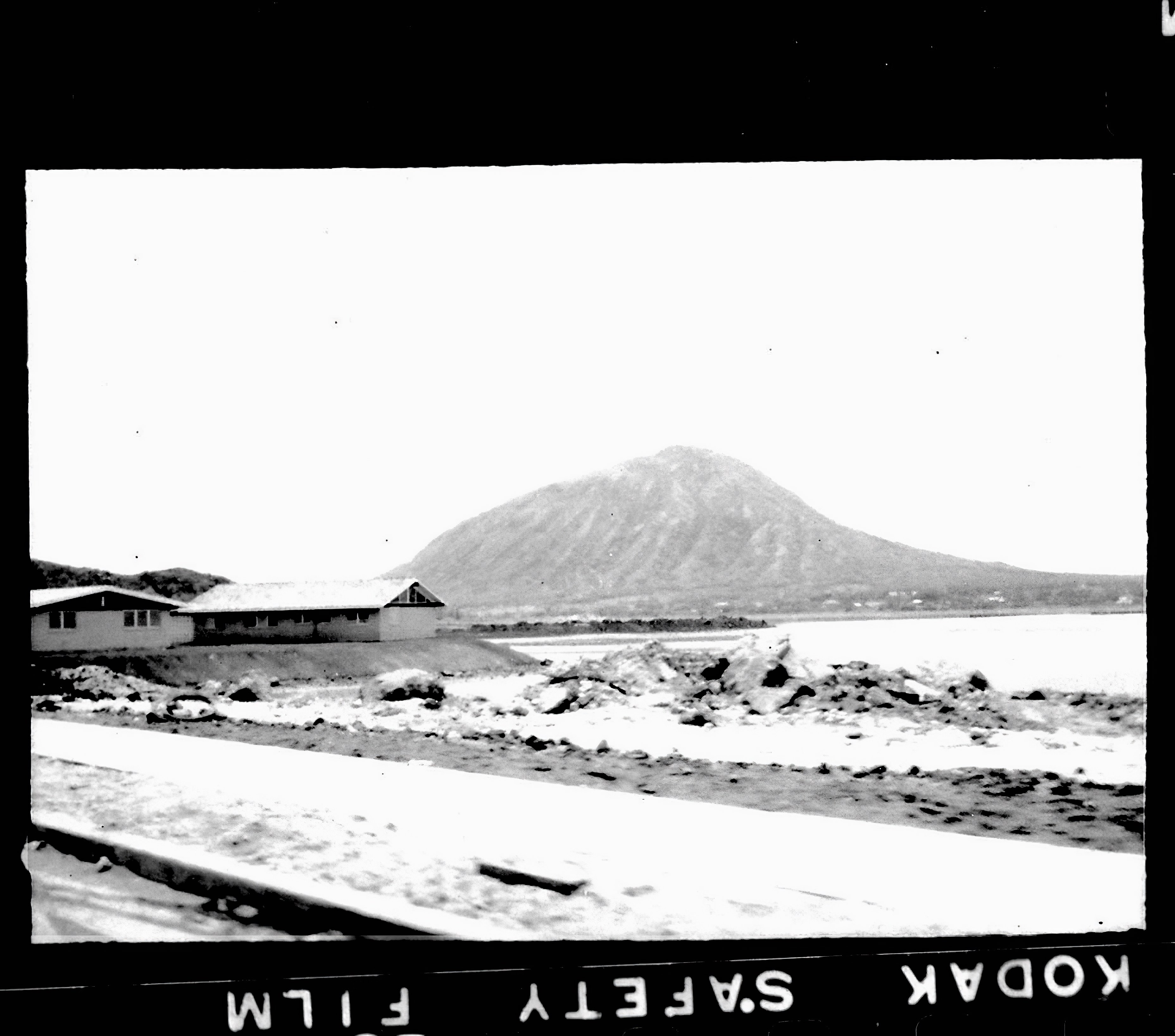
Here’s another photograph found among those I’ve been backing up from various hard drives. It was a tiny photo on a contact sheet from a roll of film I shot back in 1963. Although it was just the size of a 35mm negative, less than 1.5 inches, I was able to enlarge it.
It was next to a few photos of a visit to Hanauma Bay, and with Koko Crater in the background, it must have been taken somewhere along Kalanianaole Highway.
So the question is, where is this?
Please leave your informed guess in a comment.
Discover more from i L i n d
Subscribe to get the latest posts sent to your email.
This is the year I first arrived in HNL. That summer, my freshman year at Whitman. Is that the Kaiser estate at the far end of the point below Koko head?
The land jutting out before Portlock is either the development waterside of Kalanianiole before Wailupe, Niu Valley, or Summer Street water side of Kuliouou. I vote for the photo being taken on Kahala side of Niu.
We moved from Kahala to Portlock in ’65. Happy to find no thrips there. Hah!
I think this is from the edge of Wailupe as it was being built?