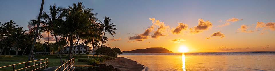
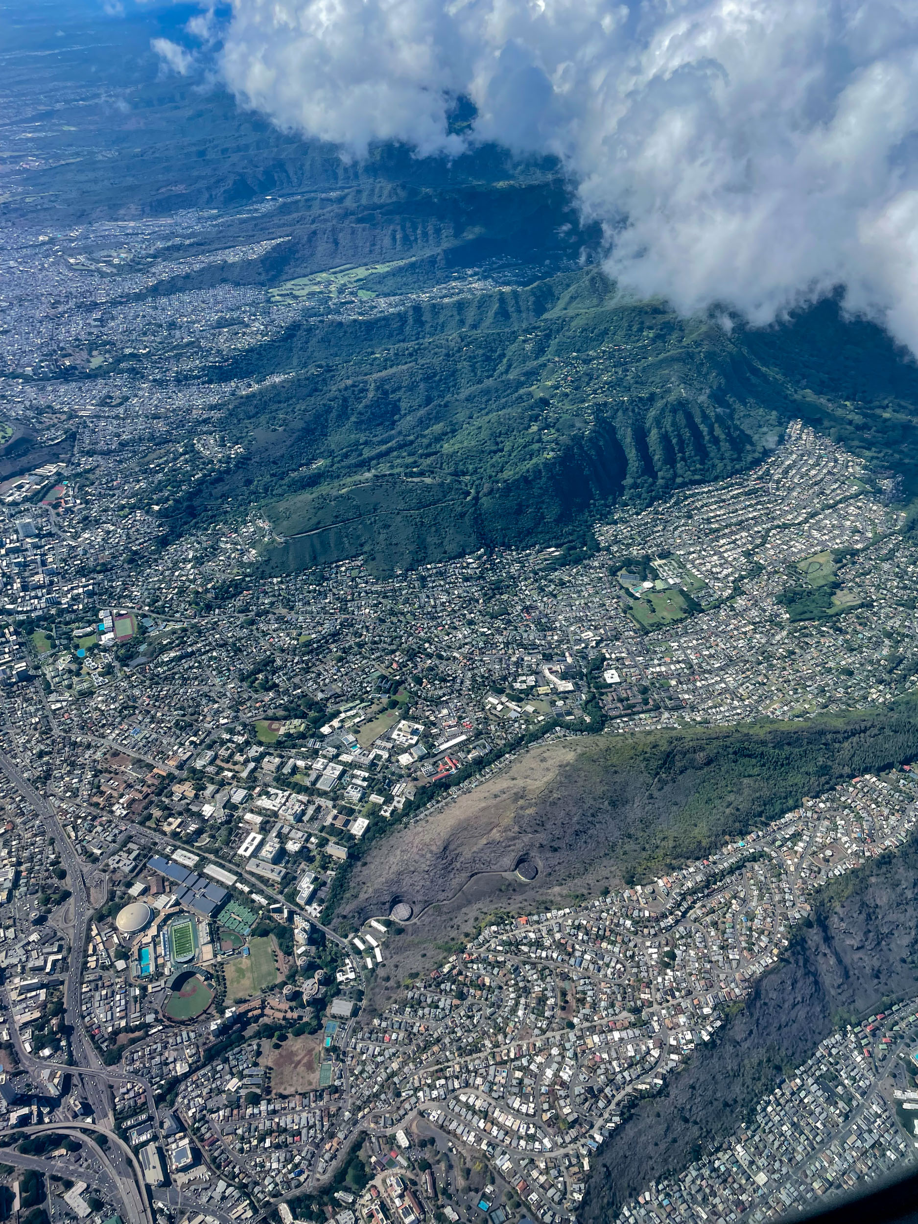
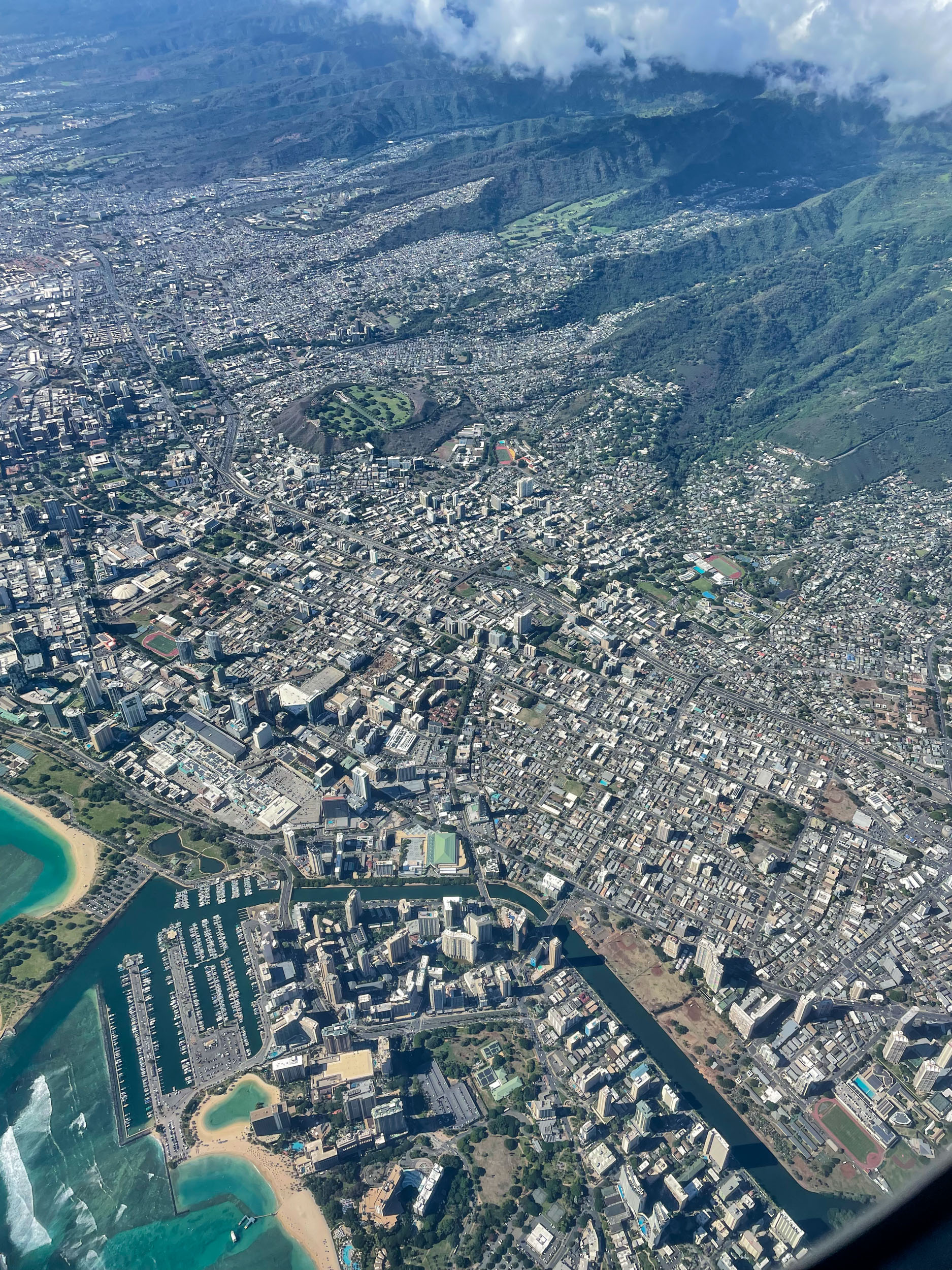
Our United Airlines flight from San Francisco yesterday afternoon approached Oahu just a bit south of Kaneohe, so the marine base was just below and to the right of our flight path. When we emerged from the clouds on the other side of the Koolau Mountains, we had sweeping views of Honolulu. Here are two that I caught with my iPhone rudely reaching over Meda, who was seated by the window.
Click to see a larger and more detailed version of either photo.
Top photo: Lower right, one piece of the residential area in Palolo Valley. Just above that, St. Louis Heights. Left side, you see the University of Hawaii campus, with the baseball and football stadiums, along with the arena and pool, and then the campus stretching out above them. Manoa Valley, then on across town.
Bottom photo: At the lower left, the Hilton Hawaiian Village Resort, with the lagoon, and Fort DeRussy, with part of Waikiki bounded by the Ala Wai Canal. A bit higher, on the left, part of Magic Island and Ala Moana Beach Park, Ala Moana Shopping Center with its associated condominiums. The Punahou School campus, all the condos of Makiki, and Punchbowl are other landmarks to be seen.
Add your own landmarks as you examine the photos.
Discover more from i L i n d
Subscribe to get the latest posts sent to your email.
Wow! Ian! A very clear day and a very good camera. The detail is amazing!
Much sharper than any I’ve taken with my “fancy” camera.
Great clarity. What kind of camera? :-).
That was with my iPhone 12 Pro.
Wow, I thought was from an SLR or mirrorless!
I was surprised by the amount of detail it retained. Often iPhone photos look really good until you try to enlarge or crop, at least in my experience.
Thank you for sharing such great photos. We maybe a bit over built, I think.
80% of the entire state lives inside these photos.
Wonderful photos and a clean window!! Thanks for sharing!
Dang. I can see the building I live in. Remarkable pictures.
Really amazing clarity Ian. Thank you