Category Archives: Tech

What is this gizmo??

[Update: Questions answered! It’s a motion-activated sprinkler, likely used to chase off any ducks or other unwanted visitors to the pool area. See the comments below! Thanks to all who responded to the post.]

What is it??

When the tide is high in the morning, we sometimes walk past a large house along the 7th fairway at the Waialae Golf Course. We have never seen the house occupied, but it is well cared for, the yard well maintained, etc. It features a pool along the golf course side.

And that’s where this question comes from.

There are a couple of tripods set up along the pool in different areas. At first I thought maybe they would occasionally hold an iPhone and take time-lapse photos of the pool area for security purposes, perhaps.

But today I took a couple of pictures so I could examine the gizmo a bit better. In the photo below, you can see that a hose is attached to the central part of the tripod. And then there’s a little controller of some kind attached.

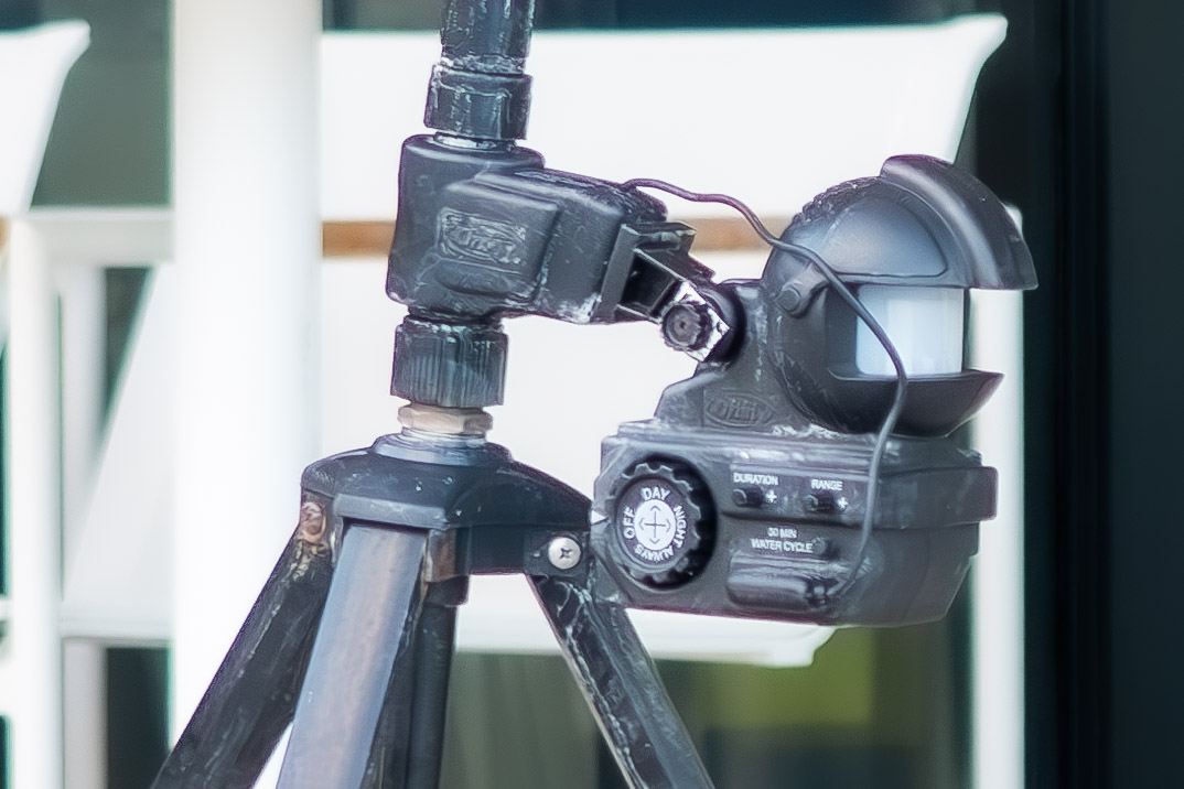
The second photo shows a closeup of the controller box. It has buttons to change the “Duration” and “Range,” and a knob that can be set for Day, Night, Always, or Off.

So the question is, simply, what is this gizmo and what is it controlling?
Part way to a digital driver’s license

I received an email notice from Apple this week:

Hawai?i residents can now add their drivers license or state ID to the Wallet app and use it to show proof of age or identity at select businesses and venues. Or, travel with it at select TSA checkpoints.

Of course, priding myself as an early adopter, I quickly opened the wallet app on my iPhone and followed the instructions. You’re asked to take a photo of your current drivers license, front and back. Then you take a photo of yourself. You are prompted until you get it right. Then you are asked to make a series of funny faces, which may just be to test that you’re not some kind of AI robot. As I recall, there’s not much more to it. Submit!

The instructions said it could take some time for your request to be reviewed and approved. But I received the approval within 24 hours.

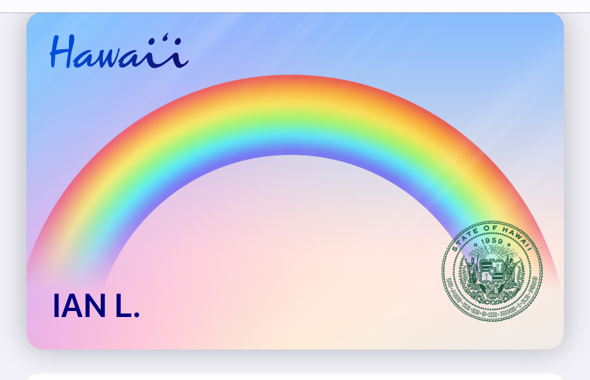
This is what I now see in my digital wallet. None of the information is visible, but is apparently stored digitally and remains secure until you tap your phone on a compatible reader.

Unfortunately, it promises more than it delivers. Getting through TSA appears to be just about the only current use for the system here in Hawaii. Honolulu Airport is one of the short list of U.S. airports where your digital I.D. can get you through security.

ID cards in Wallet are currently available for use at select TSA checkpoints within Baltimore/Washington International Thurgood Marshall Airport (BWI), Cincinnati/Northern Kentucky Airport (CVG), Daniel K. Inouye International Airport (HNL), Denver International Airport (DEN), Hartsfield-Jackson Atlanta International Airport (ATL), John Glenn Columbus International Airport (CMH), Phoenix Sky Harbor International Airport (PHX), and Ronald Reagan Washington National Airport (DCA). Travelers should refer to checkpoint signage to confirm availability.

It will likely be years before it can be used in a traffic stop, or to verify your age when carded. Those will require the adoption of equipment to “read” the cards. I’m not holding my breath.

It will sit in my digital wallet among several credit cards, an AARP membership card, along with other occasionally used cards, such as my HOP Card for paying bus and rail fares when visiting Portland, Oregon, Clipper card for riding BART when in San Francisco, and my digital membership cards for Bishop Museum and the Museum of Contemporary Art in Chicago.

Lost

That’s where Apple Maps left us on Wednesday afternoon.

On recent trips elsewhere, I’ve found Apple Maps to be very much improved, and I had mentally declared it my go-to mobile mapping app.

So when we landed at the Tri-Cities airport in Pasco, Washington, and picked up a rental car, I quickly plugged in my iPhone, opened Apple Maps, and asked for the proper route to our destination, the Courtyard in Walla Walla. Maps quickly displayed a series of instructions, and displayed a turn-by-turn map.

Coming out of the airport, it directed us to enter the roundabout and take one of the exits to a certain street. The problem was that there was no roundabout in sight, and there was only one way ahead, a right turn onto a highway on ramp. Okay, I know the app can quickly locate you and get you back on course. But instead, Maps seemed confused. It stuttered. It repeated itself. It said to turn at the corner. There was no corner, as we were now on a highway heading to Richland, not far but not where we were supposed to be going.

After several exasperating minutes waiting for the arrival of better instructions, we declared defeat. Took the next exit, found a parking lot to stop and regroup. At that point I switched to Google Maps. Bingo. A new instruction set took over, and we made the hour drive to Walla Walla without another error.

Had we stepped into an Apple Maps dead zone? Was this an isolated issue? I don’t know, but it was unsettling, for sure. Since no one has to look at a map any more, were lost without these turn-by-turn directions delivered to our cell phones.

But if that’s the biggest travel glitch we run into on this trip, I’ll consider us very lucky!

* Update: I think we’ve located the problem. We were using Apple Maps via Apple CarPlay on our rented vehicle, an Infiniti SUV (much larger that the car I had reserved, but it what was available on the ground when we arrived last week).

The problems appear to stem from the implementation of CarPlay, which somehow added a significant delay to the app’s tracking of our position and driving directions.

As an experiment, we used Apple Maps yesterday without using CarPlay and the accompanying display. Unemcumbered by all that, Apple Maps performed flawlessly, as we had been used to previously.

So the problem isn’t with Apple Maps, but with Apple CarPlay. And not CarPlay generally, since we’ve used it many times elsewhere without issues.

PGA tournament data system catches my eye

The Sony Open, one of the first PGA tournaments of the year, officially gets underway Thursday at the Waialae Golf Course, just around the corner from our house.

Things get very busy in the neighborhood, and on the golf course, in week or two before the tournament, as tents, stages, grandstands, and camera towers are put together in various parts of the course, and miles of fiber optic and power cables are laid in place around the course.

I took this photo a couple of days ago showing the cables running along what during the tournament is the 17th hole, which runs parallel to the beach. The cables appeared to be running to a television camera tower overlooking the 16th green.

On the other end, it seemed that some or all plugged into a black case that sat under a temporary pole, perhaps 10′ high, with some sort of gizmo at the top. I was curious, and took a photo of the case, which was marked “PGA Tour Shotlink.”

So when I got back home, I looked up PGA Tour Shotlink, which turns out to be an amazing data system that is temporarily installed on the course for each PGA tournament, and makes possible instant data sharing of a tremendous amount of cloud-based data.

The PGA TOUR’S ShotLink technology, powered by CDW, has tracked and recorded every professional golf shot in real time since 2001, delivering insights to fans watching at home or following tournaments through mobile apps, and providing critical data to
players striving to improve their performance.

I was just shaking my head at the complexity of this portable system, but a friend made an obvious comment: “Imagine what a system like this can do tracking demonstrators or marchers or any other public gathering or in any public space.”

It’ a whole new world.